
 |
Welcome to the | |
 |
AACES-2 Project | |
| Australian Airborne Cal/val Experiment for SMOS |
|
Home page
Google Earth (KML file) Workplan SMOS AMSR-E WindSat ASCAT PALSAR ASAR MODIS MTSAT-1R ASTER Landsat CHRIS AVNIR-2 PLMR data Thermal Infrared data Multi-Spectral data Monitoring stations Soil moisture sampling Vegetation sampling Campaign shapefiles DEM Land use Climate data Soil classification Soil water capacity Soil texture analysis AACES homepage Moisturemap homepage |
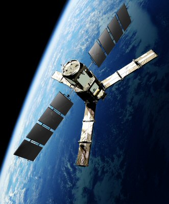
Soil Moisture and Ocean Salinity (SMOS) Source: http://vgomez.blogia.com, accessed on 28th, Apr. 2010
The SMOS satellite was launched on 2nd November 2009, making it the first satellite to provide continuous multi-angular L-band (1.4GHz) radiometric measurements over the globe. Over continental surfaces, SMOS provides near-surface soil moisture data at ~50km resolution with a repeat cycle of 2-3 days. The payload is a 2D interferometer yielding a range of incidence angles from 0° to 55° at both V and H polarisations, and a 1,000km swath width. Its multi-incidence angle capability is expected to assist in determining ancillary data requirements such as vegetation attenuation. This satellite has a 6:00am/pm equator overpass time (6:00am local solar time at ascending node). Due to the synthetic aperture approach of this satellite, brightness temperature observations will be processed onto a fixed hexagonal grid with an approximately 12km node separation. While the actual footprint size will vary according to position in the swath, incidence angle etc., it will be approximately 42km diameter on average. The features of SMOS are summarized below. SMOS data can be downloaded from ESA.
SMOS overpass timeThe SMOS overpass times for the Murrumbidgee Catchment have been calculated by the ESOV software based on the OSF file of 17th, Nov. 2009, and are provided in the table below. Date and time are in UTC.
Ascending mode
Descending mode
|
||||||||||||||||||||||||||||||||||||||||||||||||||||||||||||||||||||||||||||||||||||||||||||||||||||||||||||||||||||||||||||||||||||||||||||||||||||||||||||||||||||||||||||||||||||||||||||||||||||||||||||||||||||||||||||||||||||||||||||||||||||||||||||||||||||||||||||||||||||||||||||||||||||||||||||||||||||||||||||||||||||||||||||||||||||||||||||||||||||||||||||||||||||||||||||||||||||||||||||||||||||||||||||||||||||||||||||||||||||||||||||||||||||||||||||||||||||||||||||||||||||||||||||||||||||||||||||||||||||||||||||||||||||||||||
|
Created: September 2010 Last Modified: September 2010 Maintainer: YE Nan, Ye.Nan@monash.edu |