| |
Welcome to the | |
| |
AACES Project | |
| Australian Airborne Cal/val Experiment for SMOS |
| AACES-1 | AACES-2 |
Experiment OverviewWith the European Space Agency's (ESA) Soil Moisture and Ocean Salinity (SMOS) satellite successfully launched on 2nd, Nov. 2009, the first long-term space-borne passive microwave observations at L-band (~1.4 GHz) have become available. Consequently, SMOS is the first mission dedicated to global mapping of near-real-time surface soil moisture information. Though space-borne microwave instruments have measured global data at high frequencies (e.g. C- and X-band) for the last 20 years, this innovative L-band radiometer uses a new synthetic aperture concept that provides observations at multiple incidence angles. Consequently, the observed brightness temperature data and derived soil moisture product must both be validated. To achieve this, intensive field campaigns are being planned world-wide to support the satellite mission with reliable data from i) passive microwave airborne observations at L-band, ii) detailed ground measurements of surface soil moisture content and associated environmental parameters, and iii) long-term soil moisture monitoring network data from anchor sites (e.g. Murrumbidgee in Australia, Valencia in Spain, Upper Danube in Germany, Midi-Pyrenees in France etc.). With the SMOS launch being in the northern hemisphere autumn, Australia is particularly well positioned for conducting the first intensive SMOS validation campaign during its growing season. Murrumbidgee Catchment 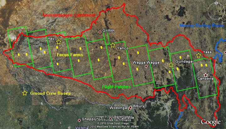 Source: GoogleEarth, accessed on 28th, Apr. 2010 (modified)
Collage of photographs of focus farms 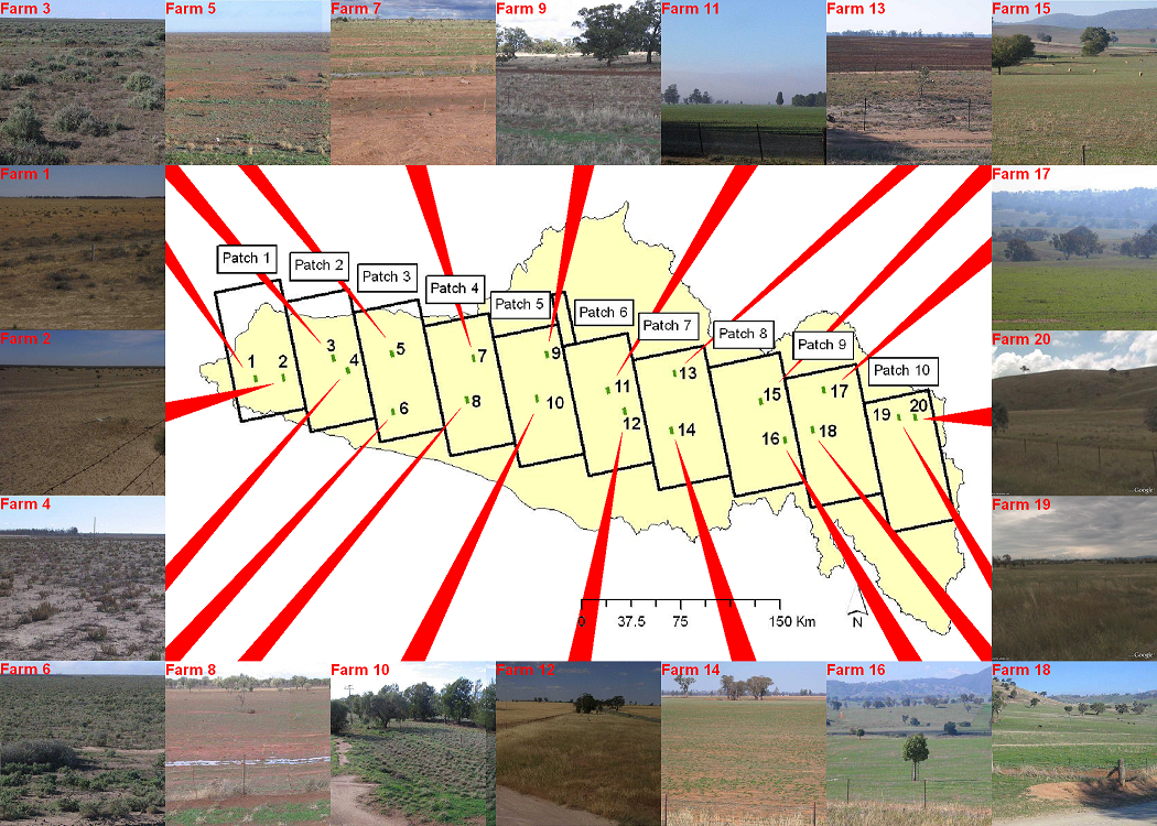
The AACES campaigns were designed to cover a large part of the Murrumbidgee River catchment capturing summer (AACES-1) and winter conditions (AACES-2). Given the approximately 50 km sized SMOS pixels, the study transect had been aligned with the SMOS fixed grid and subdivided into ten patches of approximately 100 km × 50 km in size, of which each had been mapped within a single day. The airborne observations were undertaken at approximately 3000 m (AGL) altitude to provide passive microwave data and derived soil moisture content with a 1 km spatial resolution. The primary aircraft instrument was the PLMR, used in across-track configuration (pushbroom) to map the surface with three viewing angles ( ±7°, ±21.5° and ±38.5°) to each side of the flight direction, achieving a swath width of about 6 km. The two field experiments, ACCES-1 (18 January to 21 February, 2010) and AACES-2 (8 to 26 September, 2010) have been successfully conducted and the collected data sets, sampling strategies and ancillary information are described in detail on the individual websites which can be accessed via the links below. |
|
Created: January 2010 Last Modified: August 2010 Maintainer: YE Nan, Ye.Nan@monash.edu |