| |
Welcome to the | |
| |
AACES-2 Project | |
| Australian Airborne Cal/val Experiment for SMOS |
|
Home page
Google Earth (KML file) Workplan SMOS AMSR-E WindSat ASCAT PALSAR ASAR MODIS MTSAT-1R ASTER Landsat CHRIS AVNIR-2 PLMR data Thermal Infrared data Multi-Spectral data Monitoring stations Soil moisture sampling Vegetation sampling Campaign shapefiles DEM Land use Climate data Soil classification Soil water capacity Soil texture analysis AACES homepage Moisturemap homepage |
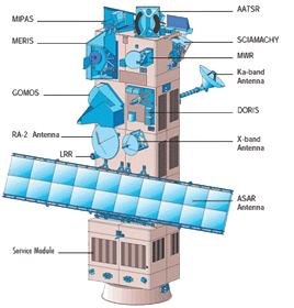
Advanced Synthetic Aperture Radar (ASAR)
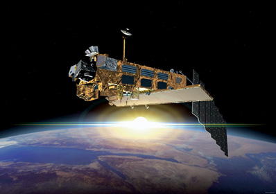
The ASAR instrument is operating at C-band and provides both continuity to the ERS-1 and ERS-2 mission SARs and next generation capabilities in terms of coverage, range of incidence angles, polarisation, and modes of operation. The resulting improvements in image and wave mode beam elevation steerage allow the selection of different swaths, providing a swath coverage more than 400km wide using ScanSAR techniques. ScanSAR is a Synthetic Aperture Radar (SAR) technique that combines large-area coverage and short revisit periods with a degraded spatial resolution compared to conventional SAR imaging modes. ASAR can provide a range of incidence angles ranging from 15° to 45° and can operate in alternating polarisation mode, providing two polarisation combinations (VV and HH, HH and HV, or VV and VH). The ASAR is onboard the EnviSat satellite, which was launched into a sun-synchronous orbit in March 2002. The exact repeat cycle for a specific scene and sensor configuration is 35 days. ASAR coverage for the Murrumbidgee Catchment is summarised in the table below. ASAR data can be downloaded from ESA.
ASAR overpass timeASAR coverage for the Murrumbidgee Catchment during the AACES-2 campaign has been calculated by a Fortran program based on NORAD data for 29th, Aug. 2010, and is summarized in the table below. Date and time are in UTC. Aircraft flights were assumed to be conducted at 7:45 for descending overpass and 20:35 for ascending overpass.
|
||||||||||||||||||||||||||||||||||||||||||||||||||||||||||||||||||||||||||||||||||||||||||||||||||||||||||||||||||||||||||||||||||||||||||||||||||||||||||||||||||||||||||||||||||||||||||||||||||||||||||||||||||||||||||||||||||||||||||||||||||||||||||||||||||||||||||||||||||||||||||||||||||||||||||||||||||||||||||||||||||||||||||
|
Created: September 2010 Last Modified: September 2010 Maintainer: YE Nan, Ye.Nan@monash.edu |