| |
Welcome to the | |
| |
AACES-2 Project | |
| Australian Airborne Cal/val Experiment for SMOS |
|
Home page
Google Earth (KML file) Workplan SMOS AMSR-E WindSat ASCAT PALSAR ASAR MODIS MTSAT-1R ASTER Landsat CHRIS AVNIR-2 PLMR data Thermal Infrared data Multi-Spectral data Monitoring stations Soil moisture sampling Vegetation sampling Campaign shapefiles DEM Land use Climate data Soil classification Soil water capacity Soil texture analysis AACES homepage Moisturemap homepage |
Compact High Resolution Imaging Spectrometer (CHRIS)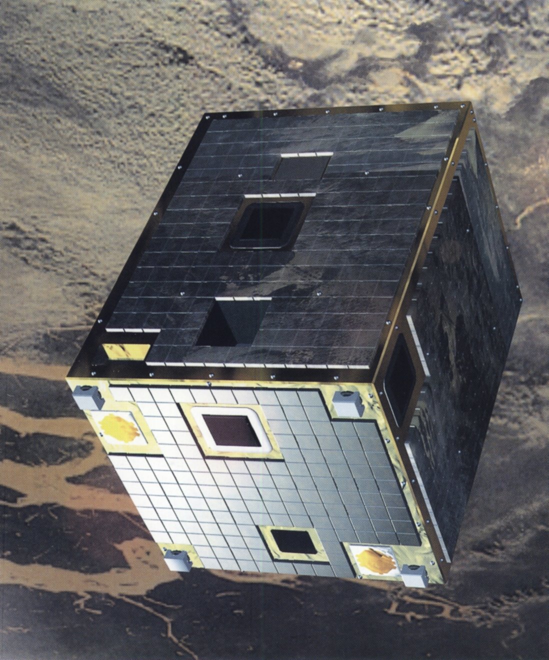 Source: http://www.lamma.rete.toscana.it, access on 28th, Apr. 2010
CHRIS provides remotely-sensed multi-angle data at high spatial resolution and in superspectral/hyperspectral wavelengths. The instrument has a spectral range of 415-1050 nm, and provides observations at 19 spectral bands simultaneously, with a spatial resolution of 20 m at nadir and a swath width of 14 km. CHRIS is on board ESA's PRoject for On-Board Autonomy (PROBA). The PROBA satellite is on a sun-synchronous elliptical polar orbit since 2001 at a mean altitude of about 600 km. CHRIS coverage for the Murrumbidgee Catchment is summarised below. CHRIS data can be downloaded from ESA.
CHRIS overpass timeCHRIS coverage for the Murrumbidgee Catchment during the AACES-2 campaign has been calculated by a Fortran program based on NORAD data for 29th, Aug. 2010, and is summarized in the table below. Date and time are in UTC. Aircraft flights were assumed to be conducted at 7:45 for descending overpass and 20:35 for ascending overpass.
|
|||||||||||||||||||||||||||||||||||||||||||||||||||||||||||||||||||||||||||||||||||||||||||||||||||||||||||||||||||||||||||||||||||||||||||||||||||||||||||||||||||||||||||||||||||||||||||||||||||||||||||||||||||||
|
Created: September 2010 Last Modified: September 2010 Maintainer: YE Nan, Ye.Nan@monash.edu |