| |
Welcome to the | |
| |
AACES-2 Project | |
| Australian Airborne Cal/val Experiment for SMOS |
|
Home page
Google Earth (KML file) Workplan SMOS AMSR-E WindSat ASCAT PALSAR ASAR MODIS MTSAT-1R ASTER Landsat CHRIS AVNIR-2 PLMR data Thermal Infrared data Multi-Spectral data Monitoring stations Soil moisture sampling Vegetation sampling Campaign shapefiles DEM Land use Climate data Soil classification Soil water capacity Soil texture analysis AACES homepage Moisturemap homepage |
Soil texture analysisDuring AACES-2 a total of 29 gravimetric soil samples were taken across the flight patches 05-08. However a soil texture analysis has only been done for soil samples collected during AACES-1, no additional soil particle size analysis was conducted for AACES-2 samples. The results of the AACES-1 soil texture analysis are shown in the image below. 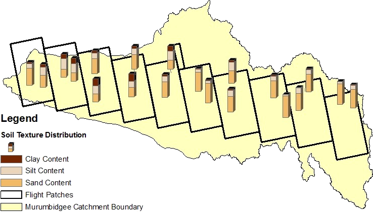
|
|
Created: September 2010 Last Modified: September 2010 Maintainer: YE Nan, Ye.Nan@monash.edu |