

| |
Welcome to the | |
| |
AACES-2 Project | |
| Australian Airborne Cal/val Experiment for SMOS |
|
Home page
Google Earth (KML file) Workplan SMOS AMSR-E WindSat ASCAT PALSAR ASAR MODIS MTSAT-1R ASTER Landsat CHRIS AVNIR-2 PLMR data Thermal Infrared data Multi-Spectral data Monitoring stations Soil moisture sampling Vegetation sampling Campaign shapefiles DEM Land use Climate data Soil classification Soil water capacity Soil texture analysis AACES homepage Moisturemap homepage |
Advanced Microwave Scanning Radiometer - Earth observing System (AMSR-E)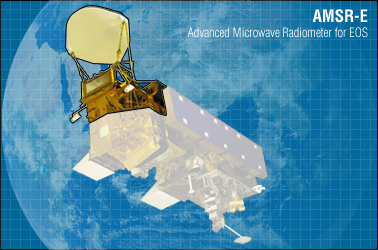 Source: http://aqua.nasa.gov, accessed on 28th, Apr. 2010
The AMSR-E sensor is a passive microwave radiometer operating at 6 frequencies ranging from 6.925 to 89.0GHz. Both horizontally and vertically polarized radiation are measured at each frequency with an incidence angle of 55°. The ground spatial resolution at nadir is 75 × 45km for the 6.925GHz channel (C-band). The AMSR-E is one of six sensors onboard Aqua, which was launched in 2002. It has a 1:30am/pm equator crossing orbit with 1-2 day repeat coverage. Several surface soil moisture products are available globally. AMSR-E brightness temperature data can be downloaded free of charge from the NSIDC website or other Distributed Active Archive Center's (DAAC's). While the current AMSR-E sensor continues to outlive its expected lifetime, a follow-on mission is planned by JAXA for the near future. The features of AMSR-E are summarized below. AMSR-E data can be downloaded from NASA.
AMSR-E overpass timeAMSR-E coverage for the Murrumbidgee Catchment during the AACES-2 campaign has been calculated by a Fortran program based on NORAD data for 29th, Aug. 2010, and is summarized in the table below. Date and time are in UTC. Aircraft flights were assumed to be conducted at 7:45 for descending overpass and 20:35 for ascending overpass.
|
|||||||||||||||||||||||||||||||||||||||||||||||||||||||||||||||||||||||||||||||||||||||||||||||||||||||||||||||||||||||||||||||||||||||||||||||||||||||||||||||||||||||||||||||||||||||||||||||||||||||||||||||||||||||||||||||||||||||||||||||||||||||||||||||||||||||||||||||||||||||||||||||||||||||||||||||||||||||||||||||||||||||||||||||||||||||||||||||||||||||||||||||||||||||||||||||||||||||||||||||||||||||||||||||||||||||||||||||||||||||||||||||||||||||||||||||||||||||||||||||||||||||||||||||||||||||||||||||||||||||||||||||||||||||||||||||||||||||||||||||||||||||||||||||||||||||||||||||||||||||||||||||||||||||||||||||||||
|
Created: September 2010 Last Modified: September 2010 Maintainer: YE Nan, Ye.Nan@monash.edu |