| |
Welcome to the | |
| |
AACES-1 Project | |
| Australian Airborne Cal/val Experiment for SMOS |
|
Home page
Google Earth (KML file) Workplan SMOS AMSR-E WindSat ASCAT PALSAR ASAR MODIS MTSAT-1R ASTER Landsat CHRIS AVNIR-2 PLMR data Thermal Infrared data Multi-Spectral data Monitoring stations Soil moisture sampling Vegetation sampling Roughness sampling Campaign shapefiles DEM Land use Climate data Rainfall data Soil classification Soil water capacity Soil texture analysis AACES homepage Moisturemap homepage |
Soil classificationSoils in the Murrumbidgee vary from sand to clay, with the western plains being dominated by finer-textured soils and the eastern slopes being dominated by medium-to-coarse textured soils (McKenzie et al., 2001). The figures below show the geology and the related soil texture distribution across the entire catchment. While, there are more detailed soil texture maps available for some parts of the Murrumbidge Catchment, particularly in the Kyeamba area (Chen and McKane, 1997), this is the best information available for the catchment as a whole. Soil type and lithology data have been sourced by the Bureau of Rural Sciences, Australia. Soil type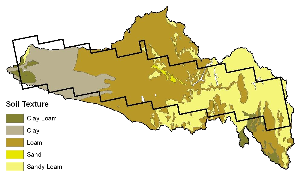 Source: Bureau of Rural Sciences, Australia
Lithology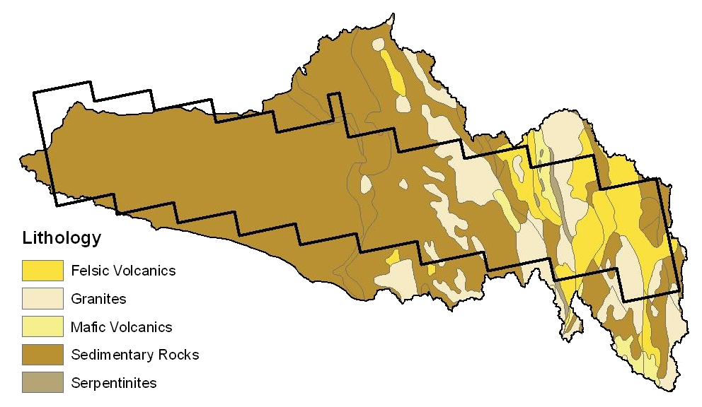 Source: Bureau of Rural Sciences, Australia
|
|
Created: January 2010 Last Modified: August 2010 Maintainer: YE Nan, Ye.Nan@monash.edu |