| |
Welcome to the | |
| |
AACES-1 Project | |
| Australian Airborne Cal/val Experiment for SMOS |
|
Home page
Google Earth (KML file) Workplan SMOS AMSR-E WindSat ASCAT PALSAR ASAR MODIS MTSAT-1R ASTER Landsat CHRIS AVNIR-2 PLMR data Thermal Infrared data Multi-Spectral data Monitoring stations Soil moisture sampling Vegetation sampling Roughness sampling Campaign shapefiles DEM Land use Climate data Rainfall data Soil classification Soil water capacity Soil texture analysis AACES homepage Moisturemap homepage |
Soil texture analysisDuring the AACES-1 campaign a total of 115 gravimetric soil samples were taken across the entire study area. The particle size distribution of a subset of those samples analyzed by using a Malern Mastersizer 2000 is shown in the image below. All analysis result can be downloaded via the Download Centre. 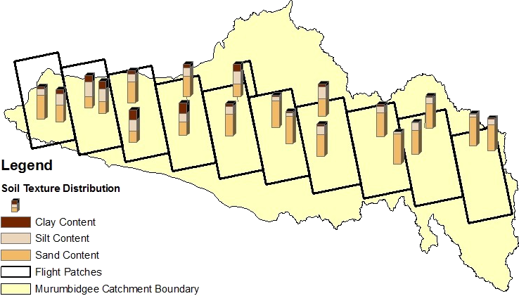
|
|
Created: January 2010 Last Modified: August 2010 Maintainer: YE Nan, Ye.Nan@monash.edu |